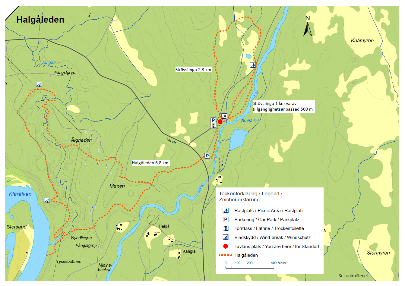
Brattfallet is 10m hight waterfall with powerfull torrents leading through short but impressive and dramatic ravine/canyon. The whole area has rich history, not only geological but also mining and other. The area is very popular and has few well sign-posted trails. The most popular is Halgaleden, almost 7km trail which takes you through very varied terrain. You can add another loop of about 2,5km for the area past the waterfall to make it almost 10km loop.
Along the trail you will find information boards which also include a map with red dot showing you your current position on the trail
Few places have directional posts such as this one
GETTING THERE
Stockholm– 360km (4h 25min)
Orebro – 190km (2h 30min)
Oslo (Norway) – 230km (3h)
By car: Parking lot available by navigating to Brattfallet. Follow S931 from either side until you see signs.
By public transport: No public transport found.
By bike: Same as by car, note that the road can be relatively busy with cars and larger vehicles and it is quiet hilly. Electric bike or good stamina is required.
Camper/ Van overnight stay:
Paid – Alevi camping. Expensive campsite but closest for visiting the waterfall, best to have (electric) bike due to hills or go with your camper/van as it is 6km on road without side walks, especially first 2km are not suitable for walking.
Several cheaper campsites are available, just slightly further away. More about Alevi campsite HERE
Free – Not in the near area, some free park ups available around Ambjorby, about 30km up the road.
The trail is very well marked with orange stripes and dots. Also example of the terrain you can expect
Information board close to the Brattfallet waterfall and ravine
TRAIL NAVIGATION
Navigation is easy since it is popular and frequented trail. It is well marked in both directions although the maps suggests to walk it counter-clockwise. Start by crossing the road from the parking lot. Follow orange dots and stripes on various landmarks. At some turns also sign posts are available. Take picture of the map, further navigation is not necessary.
You will climb couple of such ladders as on picture
Trail made of planks in the boggy areas
TRAIL DETAILS
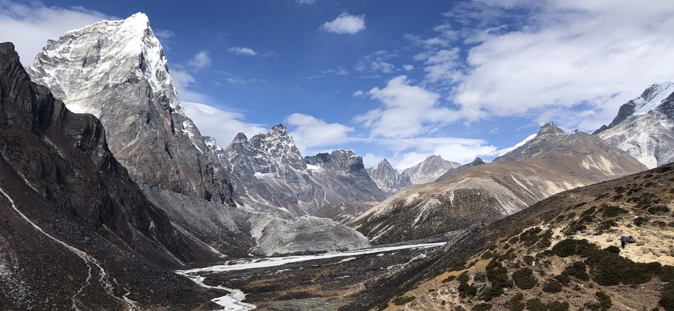
Enjoy very varied terrains and sights which makes this trail unique. Along the trail you can read information boards in English, Swedish and German which highlight some interesting facts about the area you are just passing. In addition each of these boards has a trail map with your current location highlighted, so you will understand your progress on the trail as you go. The terrain is changing very frequently and it has various difficulties. Most of the trail is easy-medium. Few parts are very technical and challenging, but usually very brief. In addition, two parts might be flooded and alternative routes are marked by yellow signs. You will face several descents and ascents, majority are without issues but there were couple which were very steep and difficult.
Terrain types
Forrest trail, easy to medium difficulty with some rocks or roots
Planks, easy to medium difficulty, can be slippery and some planks are unstable
Ladders, easy to medium difficulty, several steep but easy ladders, usually with rope
Bushy areas, easy to medium difficulty, short often uneven sections with plants on the path (also nettles)
Steep uphills/downhills, difficult terrain, usually on gravel path, one is very difficult and requires use of rope provided
River paths, easy to medium difficulty, can be very slippery and muddy
Bridge, couple very low bridges to cross small creeks
Grass meadows, easy to medium difficulty, tall grass might be challenging for navigation
Pro Tips: Do not wear shorts as few short sections had nettles. Check for ticks after your hike. Allow some time for picking blueberries or for swimming (further up from the waterfall).
This was the hardest part of the trail, short but very steep hill. If you follow counter-clockwise, you will be going down it.
During my visit, this area had very tall grass as tall as me. It made the trail slightly challenging to see
OTHER DETAILS
Tree coverage: Heavy tree coverage, good protection from sun
Geocaching: There are few geocaches in the waterfall area, none on the 7km loop. No Adventure Labs.
Dogs: It is possible to the trail with a dog, but I do not recommend. Dog must be leashed. Note that you will pass several ladders along very steep hill. Your dog must be able to walk stairs (both up and down), hike up/down VERY steep hills or you need to be able to carry your dog.
Shoes recommendation: Best completed in hiking or trail running shoes with good profile.
Hiking poles: Not necessary, but might be useful for the more technical sections.
Trail running: Suitable for experienced trail runners as the trail is quiet technical for running. Keep in mind the trail can be busy during weekend. Passing by quickly might not be always possible
One of the huts along the trail. You can also see information boards explaining you more about the area
Nice path along the river, was a little muddy during my visit
FACILITIES
There are no facilities along the way.
Restrooms: Chemical toilet at the higher parking lot, close to the waterfall.
Restaurants: At Eksharad (17km) or Stollet (20km)
Shops: At Eksharad (17km) or Stollet (20km)
PERSONAL EXPERIENCE
I completed Brattfallet hike on Friday. I had sunny and later cloudy condition. It had rained heavily the previous day. The main loop of 7km was still passable with some sections slightly muddy but without causing much issue. The smaller loop was ankle deep flooded in the upper part of the loop (around the bog), so I was not able to complete as I didnt have suitable shoes.
The trail was mostly empty in the earlier hours, got busier after noon. Expect crowds during weekend, especially if sunny.
View on the ravine while going to the waterfall. Beautiful stone bridge at the back
Many parts of the hike are on easy terrain such as this one


2 Responses