Dalberget is peak in northern Norway. It offers fantastic views on Lyngen fjord and Lyngen alps. Slightly above Dalberget is lovely day hut which offers great place for a break and on cold day there is stove with some wood.
For more challenging hike, you can continue up to Storhaugen. I also recommend visiting the war memorial site in Djupvik.
Map available at the trail head
The trail is not really well marked, but important turns have directional posts such as this one at the start
GETTING THERE
Oslo (through Sweden)– 1705km (21h)
Tromso – 200km (3h)
Alta – 185km (2h 46min)
By car: Set gps to Djupvik cemetry, there is small parking lot that is both for the trails and cemetery.
By public transport: Take bus 150 from Tromso or Storslett to Djupvik bus stop.
Camper/ Van overnight stay:
Paid – Artic-Lyngen, bit pricier campsite but with great views on Lyngen fjord and alps (2025 price per night 400 NOK, including electricity, showers and kitchen). The trail head is about 1km away from campsite.More information about campsite HERE
Free – Not available near to trail head. You can park at the parking lot at the trail head, but it is not allowed to stay there overnight.
Example of terrain and split in the trail
The start is on very easy terrain
TRAIL NAVIGATION
Navigation is relatively easy and gspx is not really necessary. The start and some turns have directional signs with distances on it. The trail has green dots on stones or trees although not very frequent or consistent. There are several side trails along the way but just stick to the main one. Dalberget peak and the day hut are not next to each other but are nearby and visible.
Official trail description and gpx map available HERE
TRAIL DETAILS
Campsite to Dalberget trail head
At the campsite pass behind the huts to the small trail leading to the grocery store and E6. Turn left on E6, I crossed it right away and walked in the ditch since E6 is fast road with large vehicles on it. After just few meters, there is trail on the right side leading up, take that trail and continue on the main trail heading up until you reach small gravel road. Turn to your right and continue on the road until you reach the cemetery parking lot, where is also map and start of the trail.
The climb starts after short plank path
Private hut, but still nice place to visit and enjoy the views
Dalberget trail
At the trail head is directional sign, the first part is very easy forrest trail at very mild incline with some rock and roots. You will get to gate, you can pass but make sure to close the gate behind you not to let grazing animals (sheep) escape. When you see 2nd small hut on your right, the proper climb starts. The incline will get gradually harder. The terrain has mostly some roots or rocks which are great for getting some grip. Some sections do not have much on it, so its bit harder, especially on descent. The trail will be slippery and muddy after (heavier) rain. You will be walking between two small rivers so navigation is easy, but you can still keep an eye on green dots along the trail. At some point there is split between Dalberget and Storhaugen, take left and cross small bridge. There is only little climb left to the Dalberget peak
Dalberget peak and hut
The trail splits to few side trails mostly to your right but continue straight to the large cairn ahead of you, which has also some mailboxes and sign on it. There are few other cairns around, but Dalberget is the one straight ahead. After you enjoy the view, you can return same way back, but I recommend visiting the hut, which is bit higher to the right from Dalberget. The way back is the same route.
Cairn marking Dalberget peak
Majority of the steep climb is along creek
Storhaugen – optional extension
The trail for Storhaugen is shared with Dalberget trail for most of the trail. Unfortunately I have not completed Storhaugen, but from my search it seems the trail is not marked and it is not very prominent, there are various routes available on ut.no, wikiloc and other sites, but it seems that you “make your own trail”. Expect another 550m in elevation in over 2,2km. If you visit the hut first you can cross the creek to join the trail in order not to loose elevation. This trail is marked as challenging.
Spakenes coastal fort
The fort is not at the same location but it is somewhat nearby so if you are in the area, it is worth a quick visit. It has rich history connected to II World War which you can learn from multiple signs available also in English. Park either by E6, there is a sign for parking lot. Although you will need to walk a bit from parking to the site. Alternatively you can drive to Spakenes, there is very small gravel area where you can park (or stay overnight), the fort remains are just up the steep hill.
Day hut just little above Dalberget
Another example of the terrain
OTHER DETAILS
Tree coverage: Some tree coverage, but also exposed areas, bring sun protection
Geocaching: No geocaches and no Adventure Labs.
Dogs: It is possible to the trail with a dog. Dog must be leashed.
Shoes recommendation: Sport or hiking shoes with good profile
Hiking poles: Not necessary, but might be usefull, especially on descent.
Trail running: Best for experienced trail runners. Except the first easy part for about half kilometer, the rest of the trail is constant climb which can be challenging for beginners.
FACILITIES
There are some facilities. Plan well ahead.
Restrooms: At trail head and at the hut above Dalberget peak
Restaurants: Not available
Shops: Not available nearby the trail, but there is 24/7 shop in Djupvik right along E6 road.
Spakenes coastal fort is worth the stop if you are in the area
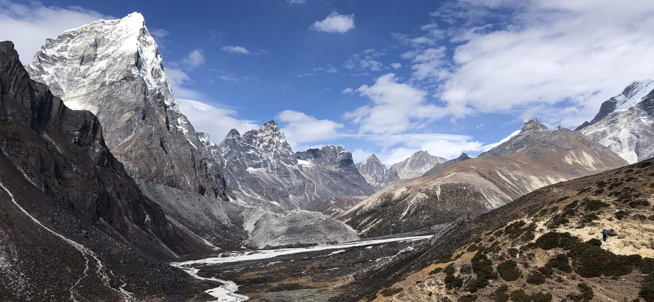
View from the day hut
PERSONAL EXPERIENCE
I completed Dalberget on Tuesday. It was warm and sunny with cold wind. I have encountered a lot of people with surprising amount of families with children. The weather was nice but I was surprised to see so many people on Thursday (afternoon). It might get crowded during weekend, especially in nice weather.
I completed small part of the trail on Friday during my run. The weather conditions were poor, rainy with lower clouds and I have not met anyone, only one car was at the parking lot.
ProTip: Bring bug spray, there was high number of flies, mosquitos and other insects.


